
Focus Area and Neighborhood Plans
Area plans may be targeted to a specific geographic location or to a topic or theme. These focused plans help implement the vision and guiding principles outlined in the Comprehensive Plan. Area plans provide greater detail and analysis on the neighborhood, study area or theme.

The Curtis Road and I-57 interchange area is a key southwest gateway into Champaign and the University of Illinois. Prior to construction of the interchange, the Champaign City Council recognized that the adjacent land would become very desirable for development. The 2016 Curtis Road Interchange Area Master Plan updates the previous Plan that was adopted in 2007. The Master Plan sets forth a vision for high quality commercial, office and residential development that appeals to surrounding residents while also accommodating interstate travelers and creating a memorable community entryway. 2016 Curtis Road Interchange Area Master Plan

Walk Champaign is Champaign’s Pedestrian Plan. Walking is a crucial part of everyone’s day. In some parts of our community, walking is convenient, safe, and comfortable. In other parts, though, the pedestrian environment is difficult and there are not always paths between places people need to visit. Walk Champaign is a commitment to improving accessibility for all residents, in all parts of the community, no matter their reason for walking. Walk Champaign Pedestrian Plan

The Champaign Trails Plan provides a comprehensive vision for a community-wide trail system. The system is designed primarily for recreational purposes and consists of three different trail types including “greenways,” “multi-use trails,” and “railtrails.” Seventeen different trail segments are identified and the opportunities and constraints for each trail are listed. The Plan also provides an implementation strategy on how the Champaign Park District and the City of Champaign can continue to build the system. Champaign Trails Plan 2011

The Bristol Park neighborhood is located on the city’s north side between Neil Street and the Canadian National Railroad and Bradley Avenue and I-74. The neighborhoods of Shadowwood, Bristol Park and Garwood all comprise the Bristol Park neighborhood. The Plan contains goals related to community development, land use, public safety, parks and open space, and transportation. The City is actively working with a developer to rebuild the Bristol Park portion of the study area with all new housing, infrastructure as well as improved parks and trails. Bristol Park Neighborhood Plan
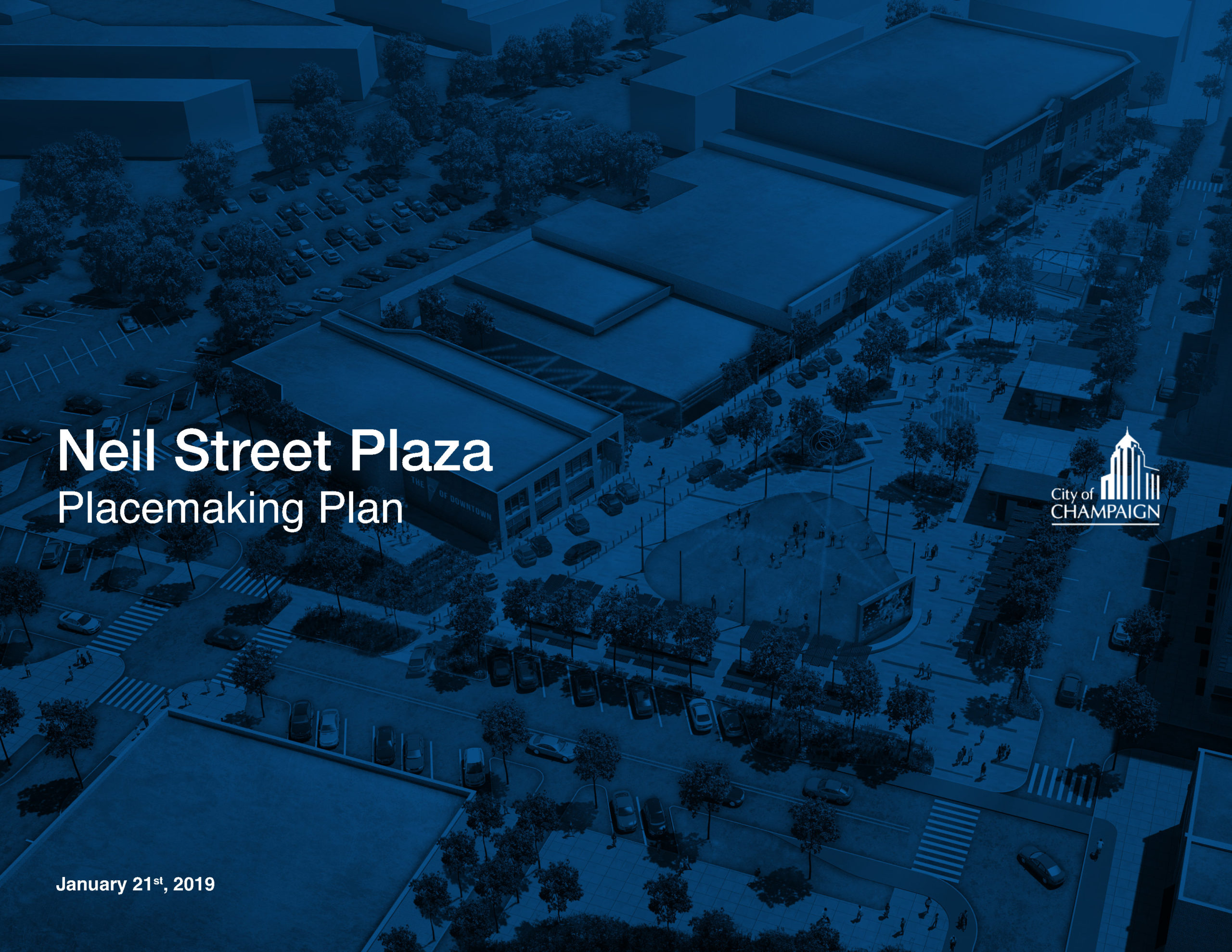
Neil Street Plaza Placemaking Plan
The Neil Street Plaza Placemaking Plan envisions a vibrant community gathering space in the heart of downtown Champaign. The elements of the plaza include a performance stage, cultural heritage walk, small business kiosks, lighted fountain, art features, green space and more. These components paired with multi-purpose, multi-seasonal programming, will create an environment that reflects the people who call Champaign home and welcomes visitors, too. The vision for the space was created with extensive public input.
The plaza will be built in three phases. The engineering study for Phase 1 can be found here.

Champaign Moving Forward is the City of Champaign’s Transportation Master Plan. Adopted in 2008, the Plan is an element of the City’s Comprehensive Plan. Its purpose is to guide policy decisions for the evolution of the city’s transportation system. The Plan places a focus on the City achieving a more complete system where facilities are provided for motorists, transit users, bicyclists, and pedestrians. The Plan also provides a “complete street” policy and outlines many implementation strategies for achieving the goals of the Plan. 2008 Champaign Moving Forward Transportation Master Plan

The Neighborhood Wellness Action Plan guides neighborhood improvement efforts throughout Champaign. Using Planning Area boundaries, each area is rated on a four-point scale to demonstrate the level of intervention needed in that area. The purpose of these neighborhood interventions is to bring all neighborhoods to a level of “Healthy.” Neighborhood Wellness Vision Report

The City’s Downtown Plan was adopted in 2006. The Plan establishes a strategic vision for the continued revitalization of the downtown area. It contains goals for land use, transportation and urban design. The Plan also provides several illustrations of infill development projects, a new downtown park plaza, and the beautification of the southern entrance into downtown. 2006 Downtown Plan
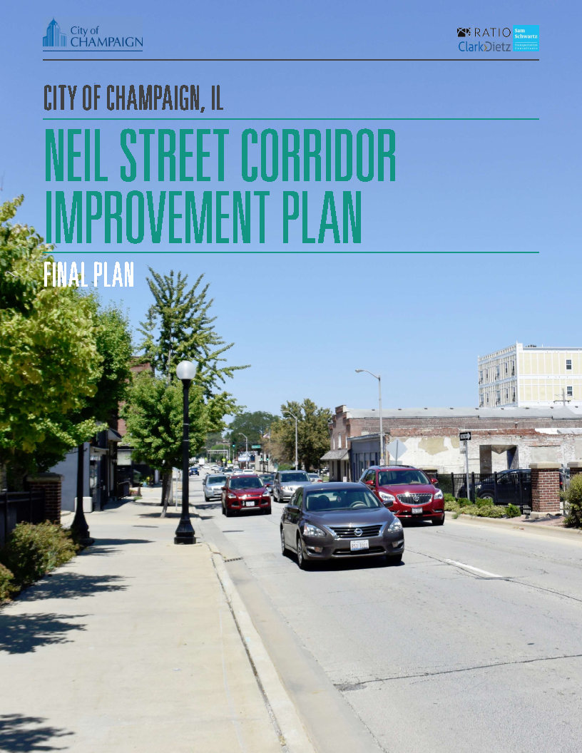
The Neil Street Corridor Improvement Plan was adopted in 2018 with the goal of creating a long range vision for one of the main entry points into the City of Champaign. The plan makes land use and infrastructure recommendations which will enhance the corridor for both – visitors to the City for the first time and residents who use the corridor on a daily basis. The plan prioritizes safety, beautification, and efficient traffic movements for multiple modes of transportation.
Neil Street Corridor Design Alternative
Neil Street Corridor Improvement Plan – Adopted Version
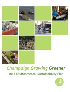
The City of Champaign’s sustainability plan Champaign Growing Greener, identifies goals, strategies and priorities in seven major areas of Sustainability: Green Economy, Water, Built Environment, Energy, Transportation Behavior, Solid Waste and Food and Urban Agriculture. The sustainability plan is an adopted element of 2011 Champaign Tomorrow Comprehensive Plan. Sustainability Plan