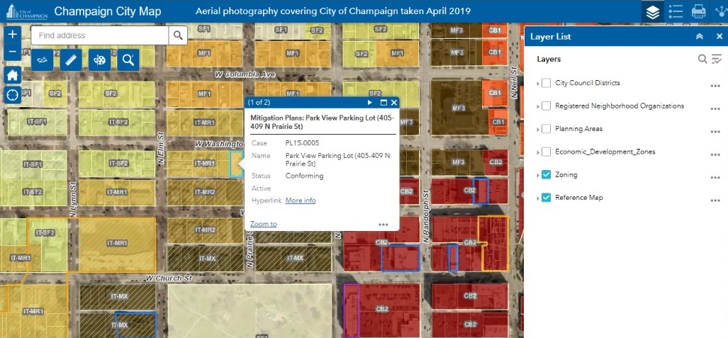
Staff from the City of Champaign’s Planning and Development Department recently worked with the Geographic Information Systems Administrator to make previously approved zoning cases, including Planned Developments, Special Use Permits, Historical Landmarks, Rezonings, Mitigation Plans, Variances, and Annexation Agreements, available to the general public through the City’s Interactive City Map. The City Map is available on the City’s website (champaignil.gov/maps), and by clicking on each zoning case, a link for “more info” will appear. By clicking on the “more info” link, access is provided to the Council Bill, Council Report, and any supporting documents or attachments. This makes zoning case information more accessible to the public and improves services to residents needing this information.